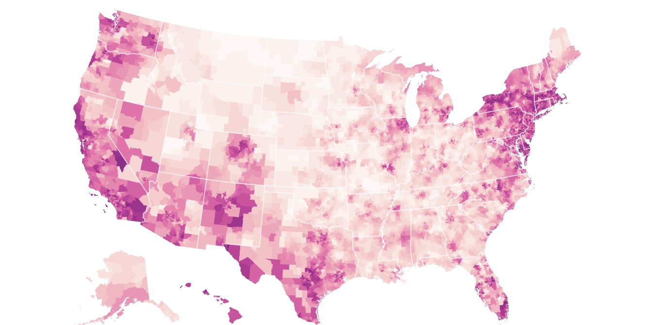
The map shows broad regional patterns: Mask use is high in the Northeast and the West, and lower in the Plains and parts of the South. But it also shows many fine-grained local differences. Masks are widely worn in the District of Columbia, but there are sections of the suburbs in both Maryland and Virginia where norms seem to be different. In St. Louis and its western suburbs, mask use seems to be high. But across the Missouri River, it falls.
https://www.nytimes.com/interactive/2020/07/17/upshot/coronavirus-face-mask-map.html?utm_source=digg